Status Quo - India-China Border Disputes
09 Jun 2020 11:48:01
On predicted lines, all attempts are being made both sides to defuse the situation by reverting to status quo ante. There are exhaustive reviews and assessments by experts on the Indian side; muted in China. To provide balanced perspective, let me highlight that Kiren Rijiju stated in the Rajya Sabha that as many as 334 cases of transgressions by China had taken place in 2014 until August 4, as compared to 411 in the whole of 2013, 426 in 2012, 213 in 2011 and 228 in 2010. Let me also highlight that there were 30 border incursions/incidents since 2013. Quoting Chief Minister Vijay Bahuguna, both Indian Express and Times of India reported that between 2006 and 2011, at least 37 incursions by Chinese forces occurred along the 350 km border that Uttarakhand shares with China.
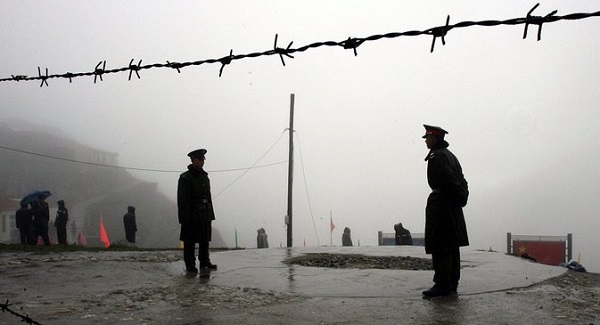
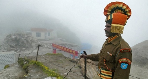
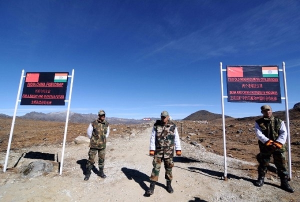
China considers India's border infrastructure upgrades in Ladakh as provocative and expansionist to include threat to its strategic road linking Lhasa to Sinkiang. Similarly, India also considers China’s border infrastructure upgrades in Akshai Chin also as equally provocative and expansionist to include securing Akshai Chin and posing threat to all forces deployed in Siachen. Reproduced is the extract of my first article: “They simply cannot afford to get embroiled in such a misadventure just as India cannot do it. At best one can describe the ongoing fracas on the Line of Control (LAC) along with Pangong Tso (one third of the Lake under Indian control) in Ladakh in the Western Sector and at Naku La in the North Sikkim in the eastern sector as “cat and mouse” game or “shadow boxing”.

The nature and character of High Altitude battle field is superficially considered. The classical view of superiority of 3:1 of attacker to achieve victory cannot govern outcomes of battles in quick time frames against a determined defender. Indian Army of today is not push-over like in 1962. What does it imply? Who ever want to launch an offensive need to build up at least 6:1 superiority If so, China needs to build up a force level 12 Divisions or 24 to 36 Combined Arms Brigades and logistically sustain them for extended periods far away from mainland. So also, India needs to do it, which is well nigh impossible.
Admiral Arun Prakash, former Chief of Naval Staff, has succinctly stated “Post-conflict, it is customary for belligerents to undertake early negotiations, in order to establish stable peace and eliminate the casus belli. Strangely, in the Sino-Indian context, it took 25 years after 1962 and a serious military confrontation in 1987 to trigger a dialogue — leading the two countries to sign the first-ever Sino-Indian Border Peace and Tranquility Agreement (BPTA) in 1993…….. And yet, the failure to negotiate a boundary settlement after 22 meetings of special representatives of the two countries cannot be seen as anything but a failure of statesmanship and diplomacy.”
Also, “In China’s grand-strategy, an undefined LAC has become a vital instrumentality to embarrass and keep India off-balance through periodic transgressions. These pre-meditated “land-grabs”, blunt messages of intimidation and dominance, also constitute a political “pressure-point” for New Delhi; especially since the Indian Parliament had passed a quixotic resolution in 1962 demanding that “every inch of Indian territory” be recovered from China.”
In scathing indictment Admiral Arun Prakash stated “Nehru has been rightly excoriated for his government’s nonchalance in the face of stealthy Chinese incursions into eastern Ladakh in the 1950s and 60s, and the lame justification offered by him for the inaction. “Not a blade of grass grows in Aksai Chin,” Nehru told Parliament, suggesting that the loss of this barren plateau was no big deal.
On anticipated lines, the fraud rhetoric of the Congress Party with Rahul Gandhi is leading the charge of the opposition parties to politicize the issue by demanding the Government to clarify that “No Chinese Soldier is on Indian soil” – skullduggery or hogwash. Nowadays, the common refrain is quite clear: ambiguity over the LAC and disputed areas. Chinese term them as “accidents of history” imposed by colonial powers when China was weak. Not to be left out from Indian point of view that border disputes were “inherited historic legacy” borne out of “Great Blunders” by Nehru post 1947. This article is focused on reviewing the complexity of the present situation in Ladakh from Chinese “Grand Strategy” and history.
Chinese “Grand Strategy”, ab initio, has been oft reiteration that boundary disputes are “inherited legacy of accidents of history” when colonial powers imposed them on weak China. And most importantly, Xi Jinping has, unambiguously, set the grand strategy course for China to traverse: strategy of ambiguity and the doctrine of “Creeping Incrementalism and Extended Coercion”. In South China Sea, they have effectively developed “Reefs and submerged islets“ into islands in assertive and aggressive manner as military bases and laid claims to control over South China Sea. On Indian borders, China has been persistently indulging in territorial nibbling through extended coercion. Few experts term it as the strategy of salami slicing that involves a steady progression of small steps, none of which is dramatic enough to become a cause of war by itself, yet which cumulatively lead over time to a strategic transformation in China’s favor.

Doklam 2017 is a good example. Now, it is followed by the 5-border intrusions/incursions: Daulat Beg Old/Depsang Plains, Galwan Valley and Pangong Tso in Ladakh and Noka La in North Sikkim. Xi Jinping’s “Chinese Dream” has shifted the goal posts of Hu Jintao’s “Comprehensive National Power (CNP) by 2030 vision to “Dominant Power” status by 2049 whilst perpetuating enduring single party Chinese Communist Party (CCP) rule. However, China is deliberately avoiding “Imperial Overstretch”, that has been responsible for the fall of many empires in the past. So, China is working to alter the status quo in Asia little by little as part of a high-stakes effort to extend its control to strategic areas and resources and to gain Asian primacy. South China Sea, Hong Kong and Taiwan are examples of Chinese initiatives.
Next, resolution of the border disputes is extraordinarily complex. For, the LAC/border was never ratified by any treaty and demarcated on the ground. The British defined the border under two lines: the Johnson Line of 1865 (Akshai Chin in Indian Territory); and the McCartney–MacDonald Line of 1899 (Akshai Chin ceded to China). Today, the Chinese claim the LAC including the Akshai Chin. In contrast, the Indian claim the Johnson Line that includes the Akshai Chin. Now, 5 treaties have been signed to maintain status quo: 1993 agreement of maintenance of peace and tranquility along the LAC; 1996 agreement of confidence building mechanisms (CBMs) in the military field along the LAC; 2005 protocol on the modalities of CBMs in the military field along the LAC; 2012 agreement on the establishment of a working mechanism for consultation and coordination on India-China border affairs; and 2013 border defense cooperation agreement.
To understand as to why resolution of border disputes is difficult, one must know the historical background in broad outline. Defining historic milestones include: 1) In 1834, Raja Gulab Singh (Dogra) armies under the suzerainty of the Sikh Empire conquered Ladakh; 2) In 1842, following unsuccessful campaign into Tibet, Gulab Singh and the Tibetans signed a treaty in 1842 agreeing to stick to the "old, established frontiers", which were left unspecified; 3) In 1846, following the victory of the British over the Sikhs, J & K region including Ladakh was transferred and Gulab Singh was installed as the Maharajah under the British suzerainty; and 4) the Maharaja regarded Shahidulla as his northern outpost, in effect treating the Kunlun mountains as the boundary of his domains.
Also, Chinese Turkestan regarded the "northern branch" of the Kunlun range with the Kilian and Sanju passes as its southern boundary. When Chinese officials were contacted by the British, they did not show any interest to negotiate the border. So, the British boundary commissioners fixed the southern end of the boundary at Pangong Lake, but regarded the area north of it till the Karakoram Pass as terra incognita. In 1865, W. H. Johnson who was commissioned to survey the Aksai Chin region, after visiting by the Khotanese ruler in his capital, noted that Khotan's border was at Brinjga, in the Kunlun Mountains, and the entire the Karakash Valley was within the territory of Kashmir. The boundary of Kashmir that he drew, stretching from Sanju Pass to the eastern edge of Chang Chenmo Valley along the Kunlun Mountains, is referred to as the "Johnson Line" (or "Ardagh-Johnson Line").
In 1878, after the Chinese reconquered Turkestan in 1878, renaming it Xinjiang, they again reverted to their traditional boundary. By now, the Russian Empire was entrenched in Central Asia, and the British were anxious to avoid a common border with the Russians. After creating the Wakhan corridor as the buffer in the northwest of Kashmir, they wanted the Chinese to fill out the "no man's land" between the Karakoram and Kunlun ranges. In 1890, under British (and possibly Russian) encouragement, the Chinese occupied the area up to the Yarkand River valley (called Raskam). Chinese also erected a boundary pillar at the Karakoram pass by about 1892. By 1892, the British settled on the policy that their preferred boundary for Kashmir was the "Indus watershed", i.e., the water-parting from which waters flow into the Indus river system on one side and into the Tarim basin on the other. In the north, this water-parting was along the Karakoram Range. In the east, it was more complicated because the Chip Chap River, Galwan River and the Chang Chenmo River flow into the Indus whereas the Karakash River flows into the Tarim basin. A boundary alignment along this water-parting was defined by the Viceroy Lord Elgin and communicated to London.
In 1893, Hung Ta-chen handed over the Chinese Map to the British consul at Kashgar. The boundary, marked with a thin dot-dashed line, agrees with the 1878 British map. It showed the boundary of Xinjiang up to Raskam. In the east, it was similar to the Johnson line, placing Aksai Chin in Kashmir territory. In 1899, the British government proposed to China via its envoy Sir Claude MacDonald, which came to be called the McCartney–MacDonald Line, ceded to China the Aksai Chin plains in the northeast, and the Trans-Karakoram Tract in the north. In return, the British wanted China to cede its 'shadowy suzerainty' on Hunza.
By the end of World War I, the British officially used the Johnson Line. They took no steps to establish outposts or assert control on the ground. From 1917 to 1933, the "Postal Atlas of China", published by the Government of China in Peking had shown the boundary in Aksai Chin as per the Johnson line, which runs along the Kunlun Mountains. In 1925, the "Peking University Atlas", also put the Aksai Chin in India. Thus, upon independence in 1947, the government of India used the Johnson Line as the basis for its official boundary in the west, which included the Aksai Chin. In 1950, the Chinese PLA took control of Tibet, which all Chinese governments regarded as still part of China. On 1 July 1954, Nehru intuitively stated the Indian position, claiming that Aksai Chin had been part of the Indian Ladakh region for centuries, and that the border (as defined by the Johnson Line) was non-negotiable. However in 1956, Chinese Premier Zhou Enlai retracted after making statement that he had no claims over Indian-controlled territory and later argued that Aksai Chin was already under Chinese jurisdiction and that the McCartney-MacDonald Line was the line China could accept.

In 1956–57, China constructed a road through Aksai Chin, connecting Xinjiang and Tibet, which ran south of the Johnson Line in many places. The road came on Chinese maps published in 1958. India found out after the road was completed, protested against these moves and decided to look for a diplomatic solution to ensure a stable Sino-Indian border. In 1959, Nehru accommodated the Dalai Lama who fled Lhasa after a failed Tibetan uprising against Chinese rule. India started sending Indian troops and border patrols into disputed areas. The aim was to create outposts behind advancing Chinese troops to interdict their supplies, forcing them north of the disputed line. China viewed this as further confirmation of Indian expansionist plans directed towards Tibet. Its result was border skirmishes and deteriorating relations with China. Mao Zedong was enraged and asked the Xinhua News Agency to produce reports on Indian expansionists operating in Tibet. Border incidents continued through this period. In August 1959, the PLA took an Indian prisoner at Longju, and two months later in Aksai Chin, a clash at Kongka Pass led to the death of nine Indian frontier policemen.
In 1960, Zhou Enlai unofficially suggested that India drop its claims to Aksai Chin in return for a Chinese withdrawal of claims over NEFA. Nehru believed that China did not have a legitimate claim over either of these territories, and thus was not ready to concede them. This adamant stance was perceived in China as Indian opposition to Chinese rule in Tibet. Nehru declined to conduct any negotiations on the boundary until Chinese troops withdrew from Aksai Chin. Even in the discussion held to settle the boundary dispute, China and India disagreed on the major watershed that defined the boundary in the western sector. Border clashes or stand-off have been endemic: 1967 (Sikkim), 1987 (Sumdorong Cho), 2013 (DBO), 2014 (Doklam) etc. China will not give up any inch of territory; just as India does not want to give up an inch of territory and also concede claims.
Viewed from historic perspective, in short term context the resolution of the border dispute in Ladakh can only be resolved at political level; but not at military level. Ipso facto, neither the Johnson Line nor the McCartney–MacDonald Line was ratified by formal treaties in the past or lines demarcated on the ground. Whatever claims India could lay to territories were squandered when Nehru stopped the Indian Army’s offensive in J & K as a consequence of which India lost its claims to Gilgit-Baltistan and Shaksgam region given on lease by Pakistan to China. And, Nehru failed to seize the opportunity of unofficial offer of Zhou Enlai that India drops its claims to Aksai Chin in return for a Chinese withdrawal of claims over NEFA.
So what? Lesson of history is simple. Power respects power. India must build up matching hard power by 2025 so that talks for resolution at the political level – soft power – are held on equal footing. Even militarily one must also consider employment of ADMs (Atomic Demolition Munitions) to deter and deny Chinese incursions/intrusions into disputed areas. Pending accretion of hard power, India must forge a new and favorable strategic equilibrium across not only Asia-Pacific region and the Indian Ocean domain, but also on the international plane as counter to China’s military doctrine of “Creeping incrementalism and extended coercion” and “Salami Slicing”.
